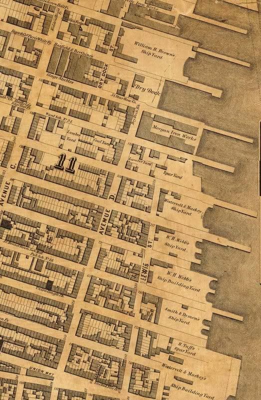
 The archaeology post from yesterday sent me to my archives to see what the area looked like in 1866 on the incredibly detailed Dripps Map (found on Library of Congress site). This portion, which will enlarge when you click on the image above, clearly shows the following businesses: William H. Bowne Shipbuilders, Morgan Iron Works, Westerveldt and Mackey Shipbuilders, William Webb Shipbuilders, Smith and Dymen's Shipbuilders, H. Taff's Shipbuilders. In the lower left hand corner of the map you can see where PS15 was (and still is) on E. 4-5th between Avenues C and D.
Monday, December 25, 2006
1866 Dripps Map And LES Shipyards
The archaeology post from yesterday sent me to my archives to see what the area looked like in 1866 on the incredibly detailed Dripps Map (found on Library of Congress site). This portion, which will enlarge when you click on the image above, clearly shows the following businesses: William H. Bowne Shipbuilders, Morgan Iron Works, Westerveldt and Mackey Shipbuilders, William Webb Shipbuilders, Smith and Dymen's Shipbuilders, H. Taff's Shipbuilders. In the lower left hand corner of the map you can see where PS15 was (and still is) on E. 4-5th between Avenues C and D.
Subscribe to:
Post Comments (Atom)


1 comment:
Hi,
I'm doing research on the dry dock area & want to thank you for pointing out this map. Very helpful!
Post a Comment