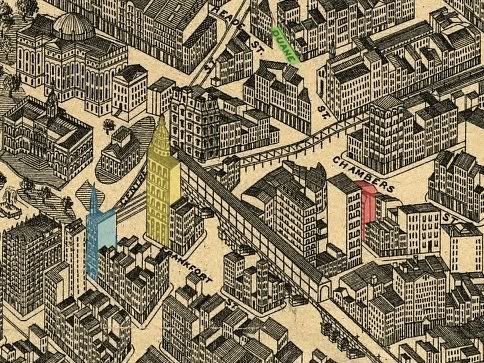
 About the map from the nine duane site
"This tiny (the full map is huge) piece of the map shows the City Hall Park/Newspaper Row area. I have colored some relevant portions of it. The red building is the DSLH (Duane Street Lodging House) (with the "Duane St." label highlighted in green). The tall building hiding it partially from view is the 10-story Rhinelander Building (erected 1893). The yellow structure is the World Building. The blue one is the Tribune; just next to it but hidden from our view is the Sun.
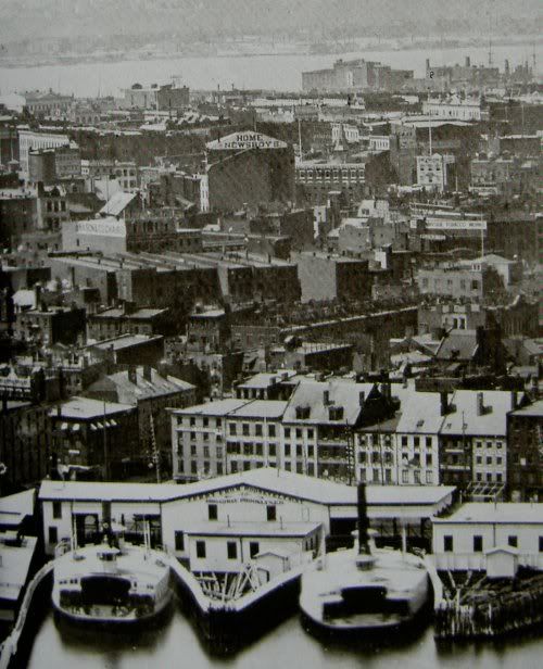 You can see how close the DSLH was to Newspaper Row, although it is only relative (compare it to the zoom-out of the Beal photo to the right, which shows that the ground distance was still quite far).
The Library of Congress does not give a specific date for this map, labeling it only as "190-?" I've narrowed it down to this date range given that (if you look at the entire map), you can see the whole Williamsburg Bridge (completed 1903), but the Tribune Building is still shorter than the World (the Tribune's height was raised in 1905)."


No comments:
Post a Comment